"Let's go to the Smokies! We can do some hiking, and I'll pack us a lunch! We'll have a picnic!"
I've been hiking in the Smokies a few times, and last weekend the weather was really nice, so it sounded like a good idea.
"Where do you want to hike?"
"Oh, I was there with my friend the other day when she came to visit, and we talked to these old people who told us about this really pretty trail with a waterfall and stuff. It'll be really easy."
"OK."
I should have asked more questions, but I was still coasting from the high of the breast cancer walk and I trust my friend, so I was kind of complacent, and didn't ask which trail we would be hiking until I was already in the car and we were already in the park. Kristin smiled innocently and answered, "Uh... it's called the, uh, Chimney Tops?"
"WHAT?"
Kristin mumbled, "Chimney Tops" while hunching defensively over the steering wheel.
"WHAT?"
For those unfamiliar with the park, please look at this photo:
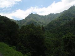
See the mountain in the back there, with the double peak? Those two peaks are called the Chimney Tops. The trail starts at the bottom of the mountain. It's an all day hike, it's fairly difficult, and it was already lunch time when we got to the park. I know a few experienced hikers who have done the Chimney Tops, and they all said it was difficult and tiring and you really needed to be prepared for it. Kristin and I were completely unprepared, in that I was wearing sneakers, neither of us had gloves or raingear, and we're both on the hefty side. I have low endurance and the muscle mass of a weak toddler, and these are hindrances to hauling myself up a mountain with no notice.
I explained all of this to Kristin, and she admitted that she had deliberately lied about our destination.
"I was afraid that if you knew where we were going you wouldn't get in the car."
"YOU WERE RIGHT! ARE YOU INSANE?"
After a few minutes of quiet, rational discussion at a reasonable volume we decided that we would stop at the information center for a map, walk as far down the Chimney Tops trail as the waterfall so that Kristin could see it, eat lunch, and then use the map to find another, less challenging hike that we could do for the rest of the afternoon. Our plan hit a snag when we couldn't find a parking space at the Chimney Tops trailhead, and then after lunch we couldn't find a space at the Laurel Falls trailhead for our backup hike. Fortunately, we found a parking space at the Little River trailhead for the "moderate" hike that the map promised us.
According to the map, we were going to go on a five and a half mile loop. We'd go a little over two miles on one trail, switch to another trail when they intersected, and then switch to a third trail when they intersected, and we'd end up back where we started. The map claimed that it was a moderate hike with many river views, and also that we would finish up by walking through the remains of the village of Elkmont, a wealthy vacation community that was absorbed into the Great Smoky Mountains National Park when it was created. No one lives in the cottages anymore, and the hotel collapsed several years ago, but the park is trying to save a few of the buildings after years of neglect because they are listed in the National Register of Historic Places. I've never been through that part of the park, so I was excited.
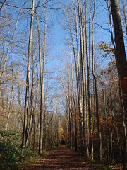
The first part of the hike went as promised. The trail was moderately flat:
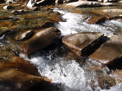
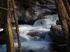
and there were a number of river views:
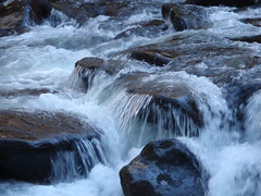
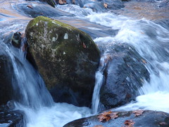

Most of the leaves are gone from the trees:
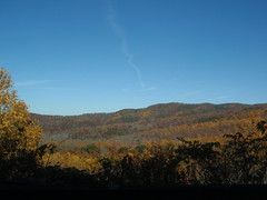
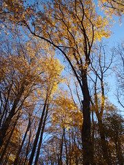
but it's still kind of pretty:
We got through the first trail fine. There were a lot of people around, but they suddenly all vanished when we reached the second trail. One pair even watched us start on the second trail, snickered, and turned away to go back the way they came. We should have followed them, but we wouldn't realize that until later. Instead, we blithely skipped along through the forest, stopping to look at butterflies:
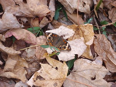
and waterfalls:
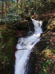
and tree fungus:
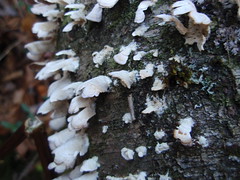
and giant orange spiders:
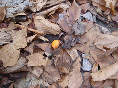
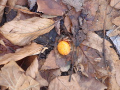
The whole time, our path was gradually sloping upward, and then all of a sudden we spent two miles walking uphill at about a thirty degree angle. Worse, the trail got progressively narrower, and full of tree roots, so that we were less hiking and more stumbling, and then we had to cross two creeks without bridges, and we had no walking sticks to help balance us.
We could have helped balance each other, but the first person across kept stopping and holding up their camera in case the second person across fell into the river.
I can't quite clearly remember which of us was the first person and which was the second.
Just as we were crossing the second creek, a little old man passed us from the other direction, said hi, and kept going. We both realized that we'd been hiking for a while and that he was the first person we had seen since we got on the second trail, and we started to wonder where the hell everybody else was. We also noticed that the sun was starting to get a little low in the sky, and Kristin kept claiming that she saw little piles of bear poop on the trail. I insisted that we would be fine, but when she showed me one of the little piles it did kind of look like bear poop. We tried to speed up, but that's kind of hard when you're climbing uphill while stumbling over tree roots and trying not to twist your ankle on them or to fall off the side of the narrow path and into a gorge.
Finally, we reached the trail crossing where we were supposed to pick up the third trail, and noticed that there was a gate across the trail. We climbed over it, and spotted this sign:
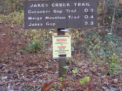
Aggressive bear activity. You know where that sign, and maybe a second gate, would have been a little bit more helpful?
AT BOTH ENDS OF THE TRAIL.
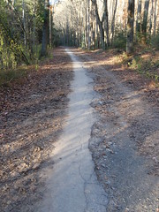
At this point we were both like, "WTF, National Park Service? And what the hell was up with that old guy passing us and not going, 'Oh, hey, watch out for aggressive bears'? WHO DOES THAT?" so we decided to just stomp down the last trail and head back to the car. This was actually kind of easy, since the last trail was for the most part the partially paved remains of the main road through Elkmont:
but now, having escaped from the danger of aggressive bears, we had a new problem: We were alone, in the woods, at sunset, in an abandoned village, on Halloween, and everyone we'd told that we were going anywhere thought that we were at the Chimney Tops in an entirely different area of the park. We might as well have just handed our spleens to Satanist hillbilly cultists and climbed up onto the altar ourselves to save time, because this was like being in twenty different horror movies at the same time.
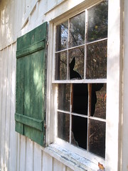
It didn't help that the village is kind of spooky when there are no other hikers around:
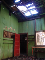
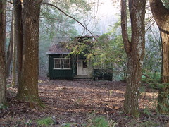

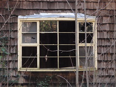
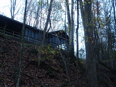
Eventually we made it back to the car, alive and with all of our internal organs intact. Then we drove to the first McDonald's we saw, inhaled cheeseburgers like we hadn't eaten in weeks, and decided that we should do this again sometime soon.
Maybe in spring, when the bears are still asleep.
6 comments:
Hilarious. You really do make me LOL.
That sounds like fun :3
That girl is going to be really mad that you called her "hefty".
I'm glad that cannibals didn't eat you. Also, the "Elkmont House Interior" photo looked straight out of Blair Witch.
You badly need "hillbillies" and "horror movie" as tags.
Avoiding hillbillies is easy. Listen for the tell-tale banjos.
Great shots, especially the waterfalls. I didn't look very closely, but I'm assuming the butterfly is a Common Buckeye (Junonia coenia), and the Spider is Araneus iviei, or other similar orb weaver. http://bugguide.net/node/view/8701/bgpage
You're so lucky to have the Smokies so close...
Post a Comment